|
|
|
| |
Satellites join watch on
Naples' volcanic hinterland « Back
to article
|
18 May 2005
Produced by the
Italian National Research Council's Institute for
Electromagnetic Sensing of the Environment (CNR-IREA), this
animation shows Phlgerean Fields deformation events occurring
between 1992 and 2000, as observed using Synthetic Aperture
Radar Interferometry or InSAR using ERS-1 and -2 images. The
animation is presented on a digital elevation model (DEM) of
the area also obtained using InSAR, with a normal
backscatter-intensity radar image of the Bay of Naples
superimposed onto the three-dimensional relief map.
Credits: CNR-IREA |
|
 |
 |
| |
|
| |
|
18 May 2005
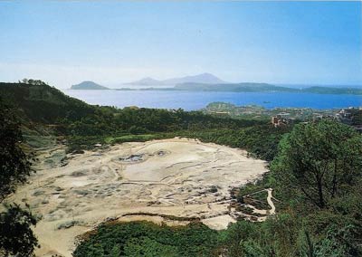
The Solfatara crater
is the most famous feature of the Phlegrean Fields, first
referred to back in the 1st Century BC. Its name comes from
the Latin for 'land of sulphur'- Sulphur Terra. It is a
subdued but still active shallow volcanic crater. Its many
fumaroles and mud pools have made it a popular tourist
attraction.
Credits: Vesuvius Observatory |
|
|
|
| |
|
| |
|
18 May 2005
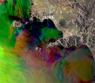
This Synthetic
Aperture Radar (SAR) multitemporal colour composite image
shows Naples and its bay. Naples, the largest city in southern
Italy and capital of the Campania Region, can be seen as the
large bright area on the northern tip of the Bay of Naples.
The bay lies within an important volcanic province, with the
volcano Mount Vesuvius and the Phlegrean Fields (Campi
Flegrei) area being its active and ancient primary
testimonies. The different colours shown by the sea in the bay
indicate sea surface roughness caused by the winds which
occurred during the dates of acquisition. The colour patches
to the north of Naples represent crop fields. The image is
made of three ERS-2 SAR PRI (Precision Radar Image) images
acquired on different dates. A different RGB colour is
assigned to each date of acquisition: Red: 11 February 2004,
Green: 21 April 2004, Blue: 30 June 2004.
The instrument
has 25 metre resolution. |
|
|
|
| |
|
| |
Keeping watch from space
on the Phlegrean Fields « Back
to article
|
18 May 2005
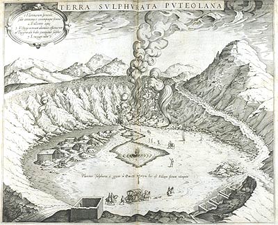
A view of the
Solfatara crater from 1717. The Phlegerean Fields remains a
volcanically active area. The last eruption came in 1538,
forming the new hill of Monte Nuovo.
Credits: Vesuvius
Observatory |
|
|
|
| |
|
| |
|
18 May 2005
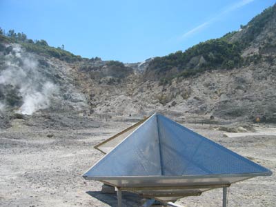
A corner reflector
for InSAR installed in the Solfatara crater during 2004 by the
Vesuvius Observatory. Corner reflectors are built to strongly
reflect the radar signal back to the satellite, so that any
movement of the feature on which the reflector has been
mounted can be measured in detail using InSAR.
Credits: Vesuvius Observatory |
|
|
|
| |
|
| |
|
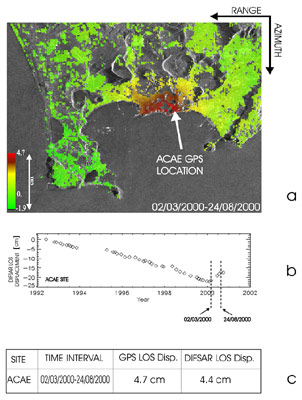
18 May 2005
The first section
(a) shows a line of sight deformation map obtained from the
descending ERS2 acquisitions of March and August 2000. (b)
Shows the temporal evolution of the observed differential
InSAR displacements, in the time interval June 1992-September
2000, for a point close to the location of the ACAE GPS
permanent station. (c) Comparison of GPS measurements (ACAE
site), projected along the radar line of sight and
differential InSAR displacements in the time interval
March-August 2000 (from Lanari et al., 2004).
Credits:
Vesuvius Observatory |
|
|
|
| |
|
| |
|
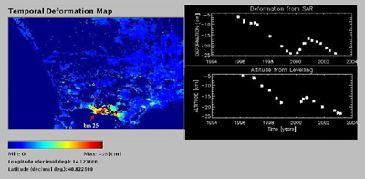
18 May 2005
Comparison of ground
deformation time-series from SAR (up) and levelling (down)
data on benchmark 25 (INGV-OV levelling line) (left): the good
temporal coverage of SAR data allows the retrieval the
information not available from levelling in the time interval
between field measurements.
Credits: Vesuvius
Observatory |
|
|
|
| |
|
| |
Knowledge from
MINERVA « Back
to article
|
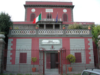
18 May 2005
The historical
building of the Vesuvius Observatory, venue of the forthcoming
workshop on monitoring volcanoes and seismically active areas
with Earth Observation.
Credits: Vesuvius
Observatory |
|
|
|
| |
|