Balkan Museum - Balkanski Muzej
I will
present historical artifact find by myself on different sources
in area of former prehistoric area of Illyricum
and present Balkan countries
Hooks for
tightening ships and boats in Balkan peninsula area.
Alka-e za vezivanje brodova
na prostoru Balkanskog poluostrva.
Crater lakes can formed after explosive volcanic eruptions or AFTER LANDING OF HUGE SPHERE OF FROZEN ICE. This is my theory which I would like to explain via different information sources I found world wide. In my work about EGGs shell and cell theory is visible that planet Earth is a HUGE EGG SHELL and our SUN is a HUGE EGG SHELL, which time to time make an DELIVERY as a "NEW BORN BABY"... This come out as an huge WATER MOLECULE IN SHAPE OF SPHERE...
What is this new born baby?
This is always visible to humans as an huge tectonic movement of earth surface, known to humans as earthquake, huge flooding and so huge structural changes on EARTH SURFACE and lost of many civilizations. We found the as archeological discoveries and still do not know many things about the. My theory offering some solutions and discoveries regarding this UNKNOWN. This is my theory which I will try to prove and make scientist to start thinking different then in all this past time.
This web site and pages is my work where trying to explain some changes I feel around me and one of this craters as I see their formations. I am sure that science will find many common points which can not be explained scientifically but can be very easy explain if follow my work and theory. I discover few of them in area of Balkan peninsula, one is Kosovo crater and one is Sarajevo crater I found from satellite images. Sarajevo crater is explained on this web pages in more details. I will explain in following web page in more details hooks for tightening ships and boats in Balkan peninsula area available after my research done in last 10 years.
Below is how is Sarajevo crater today, image from satellite.
Many European crater lake basins are quite ancient allowing, in some cases, climate change reconstruction's to be undertaken over one or more glacial-interglacial cycles.
Below is how is Sarajevo crater today, image from Landsat-4 satellite.
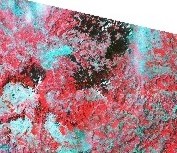
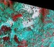
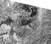
Ovako Sarajevska kotlina izgleda danas...slika satelita Landsat-4
I focused on two craters design by frozen ice in shape of sphere, as one I found in Kosovo and one I found in Sarajevo area, Bosnia and Herzegovina. From high resolution satellite images is visible that something happened in this regions, mean Kosovo crater and Sarajevo crater and from my analysis and research I come to conclusion that this was done by SO HUGE DEEP FROZEN SPHERE who land somehow on the surface of our planet. This sphere comprising many levels inside and was divided in kind of crystal form inside. Still not clear how was that. Sphere comprising "ingredients" as water, different organic and non organic material and different life forms. More about this system and method of implanting new life at any planet surface you can read here, this is my article and research in EGG formation in human skin in an landing principle as an space ship.
Below image is one example how this huge crater can be viewed in the past from above, this is just animation example how I see that.
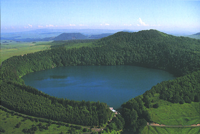
Krater i njegvo jezero je samo primjer, kako je to vjerovatno izgledalo nekad, gledano sa visine.
SARAJEVO CRATER and hooks for tightening ships and boats in Balkan peninsula area.
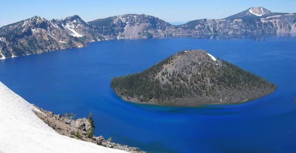
FOTOGRAFIJA ISPOD JE FOTO MONTAŽA - ANIMACIJA
Mrkovići Bukovik Crepoljsko |
||
Koševo brdo Hum brdo Rajlovac brdo Nestali dio koji se provalio u sarajevsku kotlinu, da li kao voda ili kao led. Mojmilo Lukavica |
 |
Romanija
Jahorina |
Pogled je sa ivice nekadašnjeg kratera gdje je danas planina Trebević. Ova fotografija je moja animacija. Ovako sam ja to vidio i doživio kao OOBRAAZ iz davnina... |
||
This map present points where I found hooks for tightening ships and boats in Balkan area. Click on image for high resolution map.
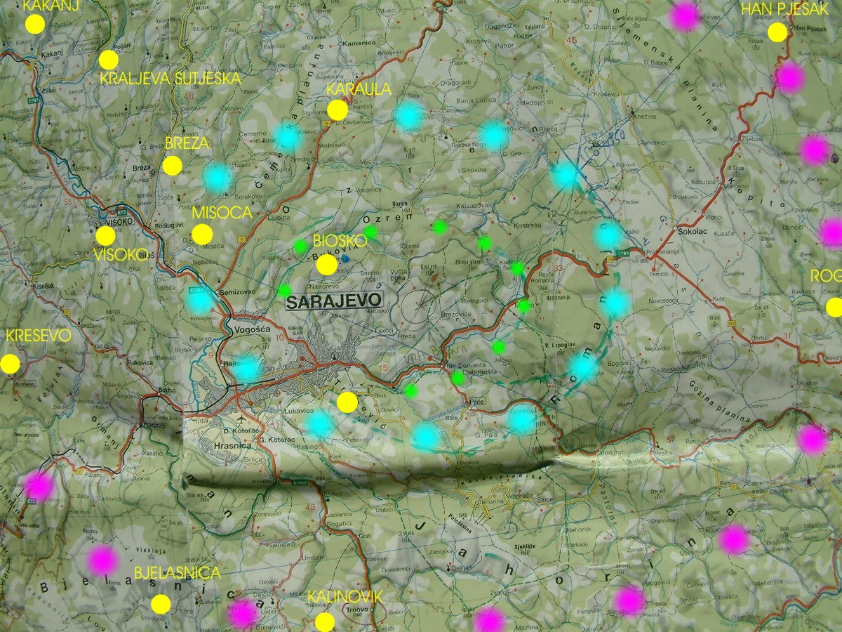
Ova mapa-karta-zemljovid daje prikaz nekih tacki gdje sam nasao Alke-e za vezivanje brodova na prostoru Balkana. klikni na sliku za vecu kartu.
This drawing map represent MOUNTAIN CHAINS surrounding Sarajevo as is now.
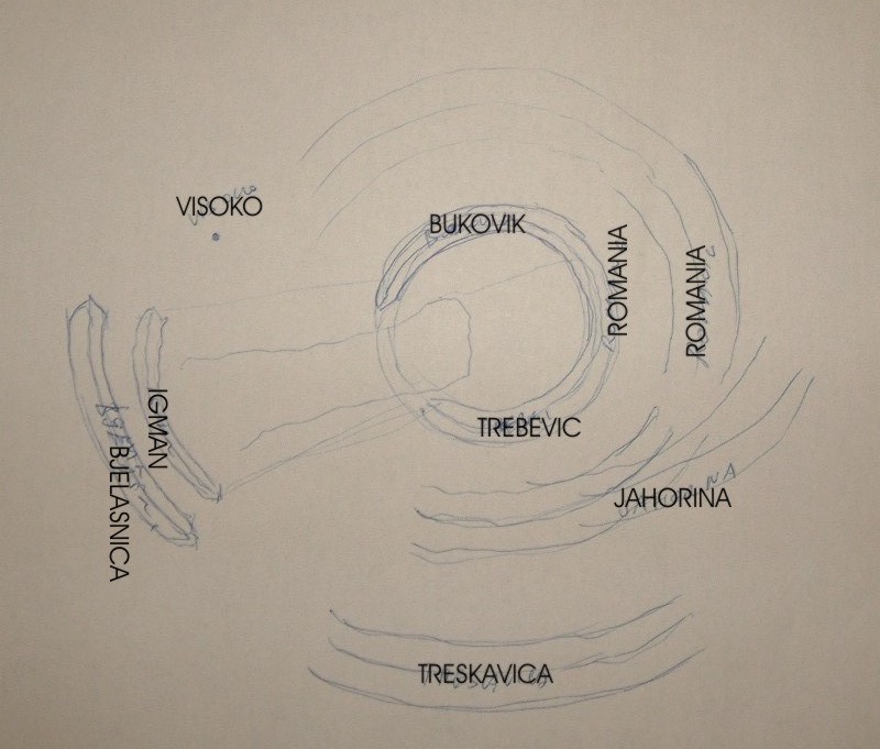
Ovaj crtze predstavlja LANCE PLANINA oko Sarajeva kao sto je situacija sad.
This drawing map represent center of CRATER in the past with surrounding mountains.
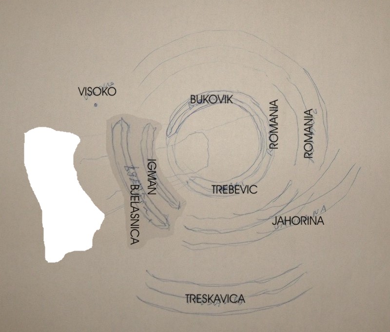
Ovaj crtez predstavlja LANCE PLANINA NEKAD i centar tog KRATERA.
MOVING SLOWLY OR FAST COMPLETE MOUNTAIN IGMAN AND BJELASNICA ON PRESENT PLACE WHERE IS WHITE COLOR NOW ON DRAWING.
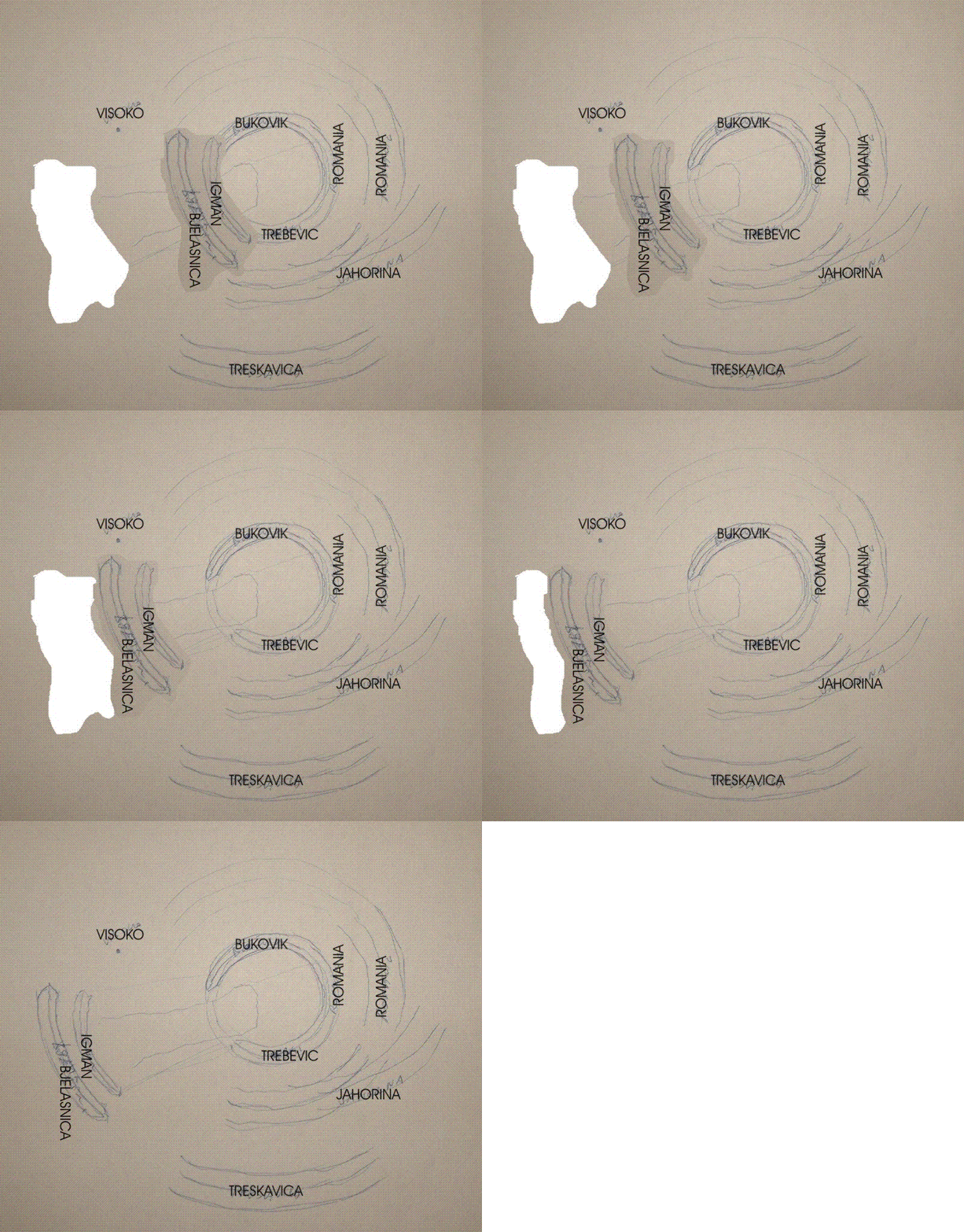
KLIZANJE PLANINA IGMAN I BJELASNICA NA DANASNJE MJESTO BJELO MJESTO NA CRTEZU.
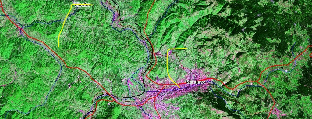
This crater has his length from hill named GLOG, yellow point and is above the part named HRESA, this is southwest slope of mounatin CREPOLJSKO. Alone BLACK CIRCLE represent huge bottom, lowest part of SPHERE, which found place to be. Second part of this lowest part of SPHERE was east to the today village named VUCJA LUKA, this is green point, near Sarajevo, as is situation now.
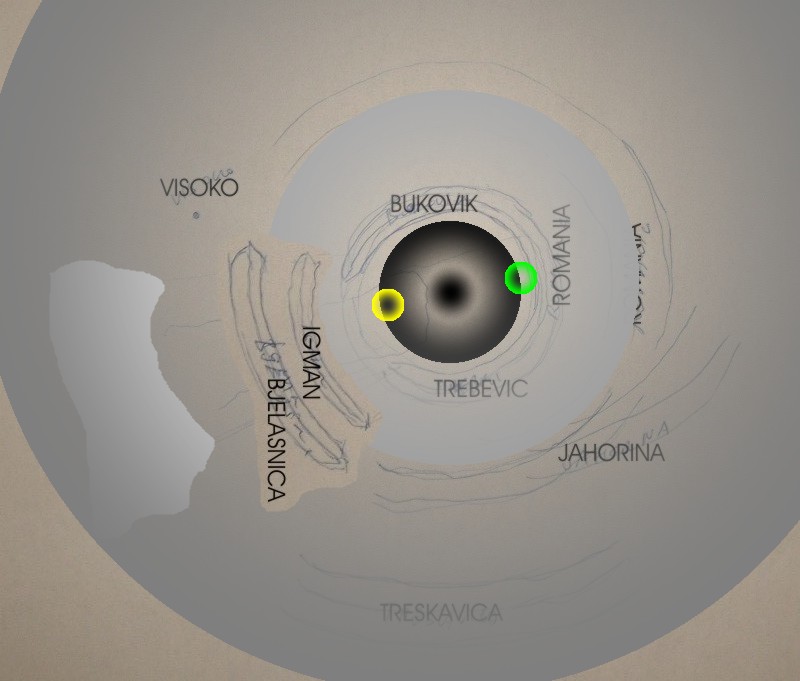
OVAJ KRATER SE PROTEZE od brda zvanog GLOG, to je zuta tacka, iznad dijela koji se zove HRESA, a to je samo jedan jugozapadni obronak planine CREPOLJSKO. Sam CRNI KRUG predstavlja naj donji dio SFERE, koja se tu ugnjezdila. Drugi dio naj donjeg dijela te SFERE, sfere se nalazio istocno, do danasnjeg sela sa imenom VUCJA LUKA, to je zelena tacka kod Sarajeva kao sto je situacija sad.
| PRVI KRUG KRATERA - FIRST CRATER CIRCLE POINTS | DRUGI KRUG KRATERA - SECOND CRATER CIRCLE POINTS |
| JUG - SOUTH | JUG - SOUTH |
| planina Trebevic, iznad Sarajeva, BiH. | predio planina Prenj, BiH, |
| selo Kljuna, Nevesinje, planina Velez,, | |
| selo
Ljušići, grad Ulog, put prema grad Kalinovik, BiH. selo Dobro Polje put prema Kalinoviku, putni pravac Sarajevo-Foca, BiH. |
grad Stolac, BiH, |
| ISTOK - EAST | ISTOK - EAST |
| selo Cude kod Olava - Han Pijesak, BiH, | |
| iznad same Rogatice, predio Rogatica, BiH, | |
| SJEVER - NORTH | SJEVER - NORTH |
| selo Gornje Biosko, obronci Bukovik, planina Crepoljsko, Sarajevo, BiH. | predio Tuzla-Brcko, planina Majevica, BiH. |
| putni prevoj Karaula, put Sarajevo Tuzla, BiH, | |
| pored puta izmedju Breze i Vareša, prije odvojka puta za selo Titorice, podrucje grad Vares, BiH. | |
| stijeni u kanjonu rijeke Misoče kod srednjevjekovnog grada Dubrovnika, ilijaski kraj, Ilijas, BiH. | |
| selo Skenderovići i sela Zlokuća, kakanjski kraj, Kakanj, BiH. | |
| ZAPAD - WEST | ZAPAD - WEST |
| visocki kraj, Visoko, BiH. | selo Klopče kod Zenica, |
| sela Lokve koje se nalazi negdje povrh Busovače, BiH. | sela Lađice, predio oko grada Zenica, BiH. |
| u gornjem toku rijeke Bile, selo Gluha Bukovica, BiH. | sela Gajci koje se nalazi povrh KP Doma Zenica, BiH. |
| selo Umoljani, planina Bjelasnica, Sarajevo, BiH. | ratni put i stijena iznad Travnika, BiH. |
| selo sa imenom Bosnjak iznad grada Kreseva, BiH. | travnicki kraj, stijena Kozica, jedan od vrhova Vlasic planine, BiH. |
| planina Vranica, predio Prokosko Jezero, BiH. | |
| selo Zukici, stijena u Han Bila 1937. godine, dolina rijeke Bila, BiH. | |
| TRECI KRUG KRATERA - THIRD CRATER CIRCLE POINTS | |
PAŽNJA SVIM KORISNICIMA OVOG MATERIJALA, SVE STO JE NAPISANO I SVI CRTEŽI SU COPYRIGHT
Copyright C 1952-2005. All rights reserved. Rudolf Bosnjak.